The German plans to change the border with Hungary by splitting Prekmurje between the two and including Porabje to the Reich did not materialize due to the newly-formed alliance. After the annexation of Prekmurje to Hungary, the political border between the Slovenes of Porabje and Prekmurje was abolished. The interwar Trianon border that cut between the people of Pomurje and Porabje thus became open once again during the war. A traffic connection was established between Prekmurje and Porabje, but more importantly, personal and family contacts were re-established, which was reflected, among other things, in marriages between the inhabitants of both regions. The Prekmurje Company, which extended its radius of operations to Porabje, also contemplated the idea of a common Slovenian territory. Despite attempts to annex Porabje to Tito's Yugoslavia after the war, the borders drawn between 1919 and 1920 remained unchanged. The idea of changing the population also did not come true.
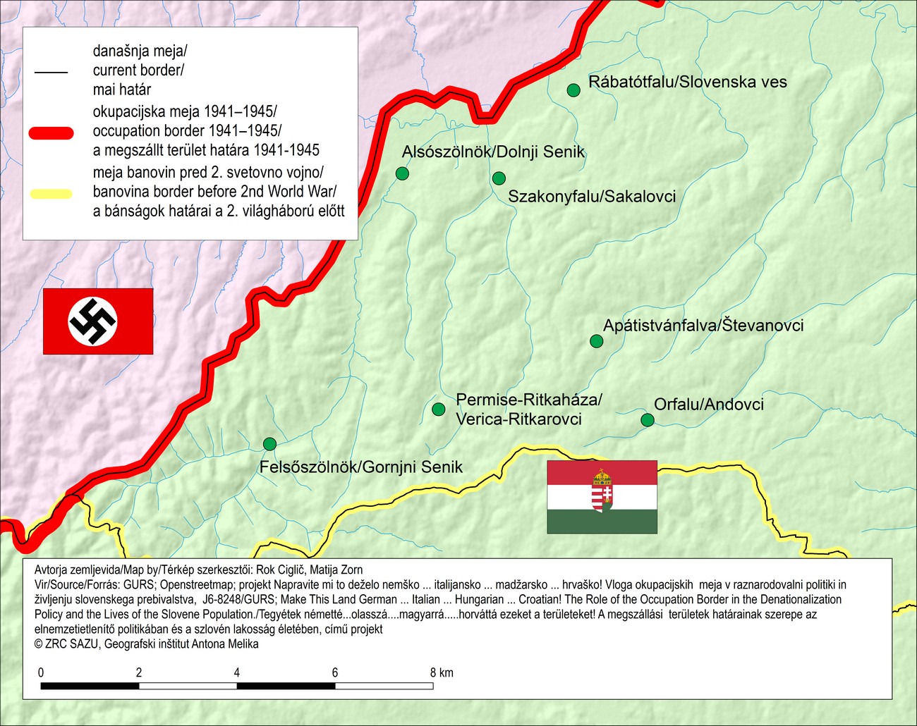
The map of Porabje during World War II. In the nine local villages that were separated from the rest of the Prekmurje inhabitants by the Trianon border after World War I, 4166 people were speaking Slovene as their first language, based on the 1920 census.
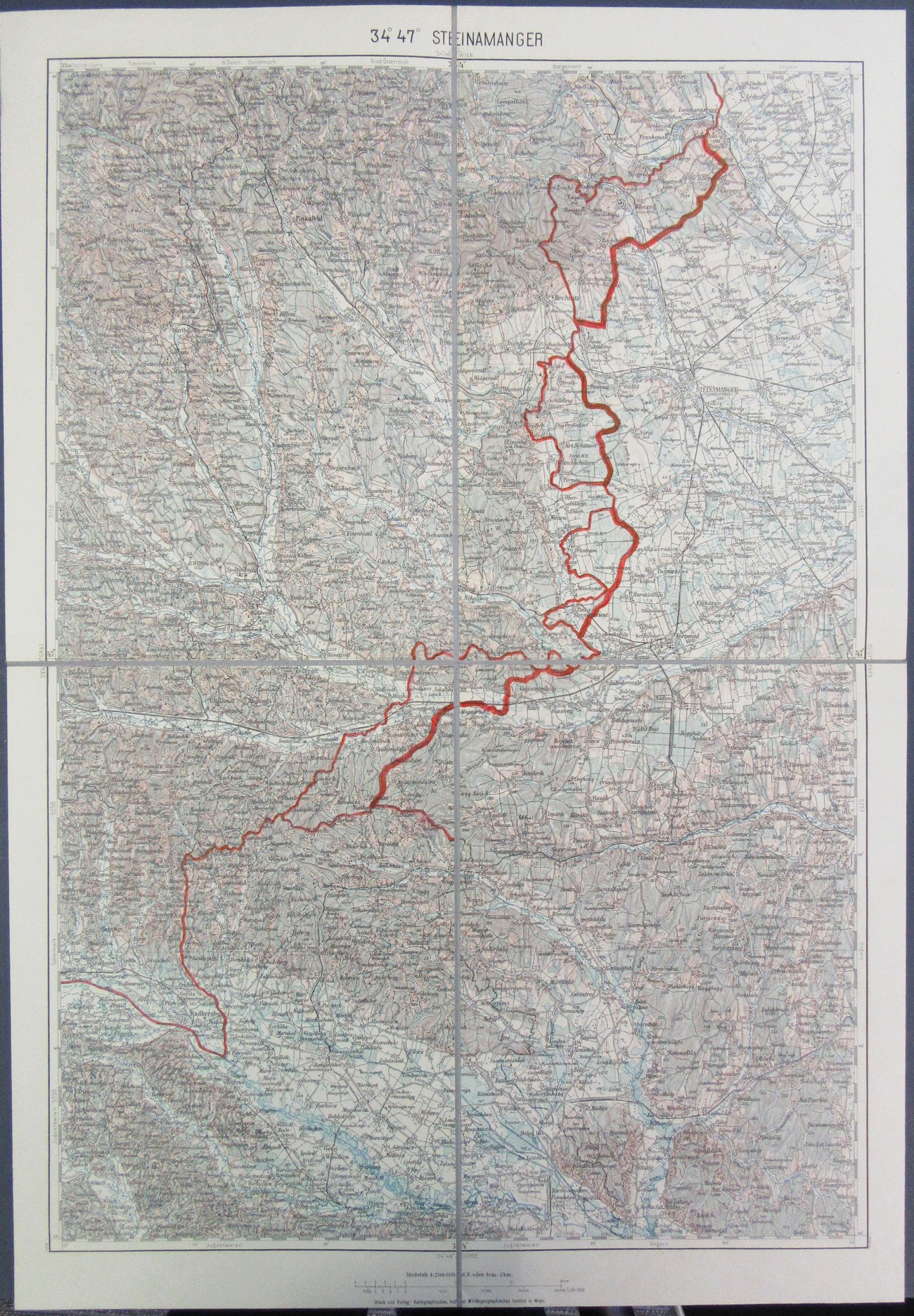
The unimplemented German plan for a new border that included Porabje, published by the Cartographic (formerly Military-Geographical) Institute in Vienna. They planned to annex the territory in the direction of Ritkarovci-Verica in the area of the Two Valleys (Kétvölgy) in the south and southwest, all the way to Katinberg (Katicin breg; Katharinaberg) next to the Hungarian-Yugoslavian border. Politisches Archiv des Auswärtigen Amts. Berlin (1934-), R 105159, Pol. XII 39. Kartenbeilage XI. Geheime Reichssache.
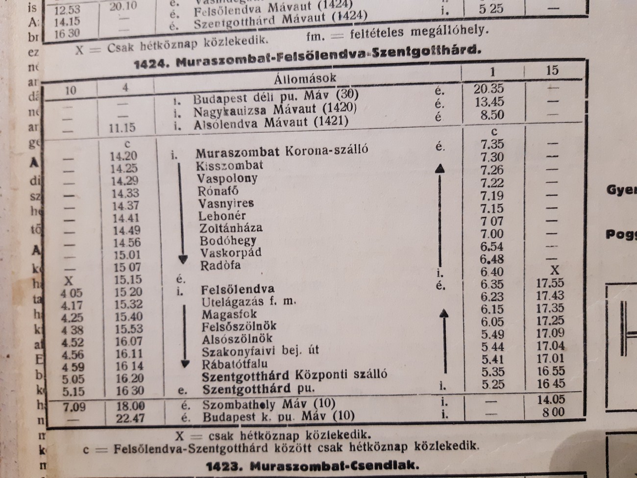
Bus timetable for the Murska Sobota - Monošter route during World War II. The line ran through four Porabje villages. MéV, volume XXXV, No 1, 4.
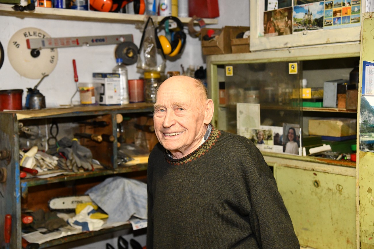
»There was already a sense of war. There was no peace, no salt, only for those who sold themselves to Hitler. During the war there was a great poverty in Gornji Senik.« (Mihael Ropoš – Miška, Ritkarovci, January 27, 2020). Author: Božidar Flajšman.