Menu

School during the War and the (Joint) Use of School Buildings

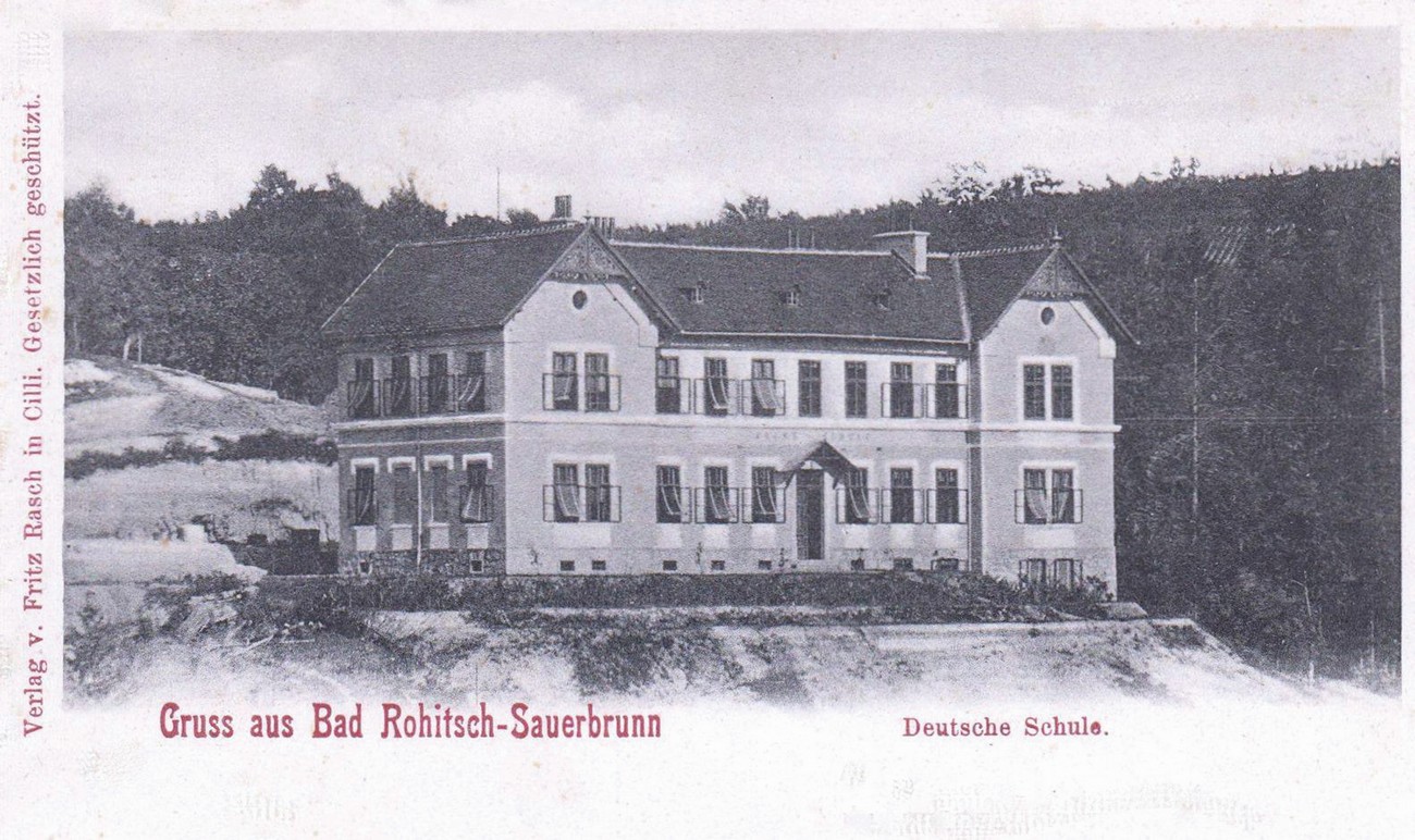
During German occupation, three mixed primary schools operated more or less continuously: in Kostrivnica (four classes), in Sveti Križ (10 classes) and above the municipal building (6 sections); the latter had been built back in 1889 by the Viennese society Schulverein for Germanisation purposes. The Germans also established a home economics school and a German craft and vocational school. By the end of the war, German lessons and the dull instilling of Nazi ideology were also taking place in private homes and inns (usually of deported owners), and in the Teachers' Hall above the health resort. All school institutions shared the same fate. As the occupier began to exercise its power, Slovene teachers and head teachers were moved (first voluntarily, and later by force) or deported across the border to Croatia; immediately afterwards arrived German-speaking male and female teachers, mostly from Austria. The school and teachers' libraries containing Slovene textbooks, which the occupier's teaching staff replaced with German books, were burnt and destroyed. In Rogaška Slatina, lessons in the German language began on 1 May 1941. The children were educated very strictly and were disciplined harshly and unrelentingly. The teachers were no strangers to pulling hair, beating, punishing and locking children up after class. A post-war school report states that at the time of the liberation the pupils of Rogaška Slatina were “unruly, absent-minded, forgetful, undisciplined and brutish”; the occupier's teaching staff also rated them very poorly: “filthy, ragged, rebellious and stupid.”

In both schools in Rogaška Slatina lessons continued until the autumn of 1944, when Rogaška Slatina was turned into a construction site of defensive systems and barriers as the broader hinterland of the border was being fortified. The occupied Rogaška Slatina became the base of the construction headquarters of the 3rd Fortification Detachment, which engaged a huge number of local and foreign workers, who were housed in both schools and in the Teachers' Hall until the end of the war. Consequently, lessons in those institutions came to a halt. On 2 October 1944, the school of the Viennese Schulverein was even converted into a work camp to accommodate the workers performing fortification works in the vicinity of the Sotla River. The school building became a penal camp.

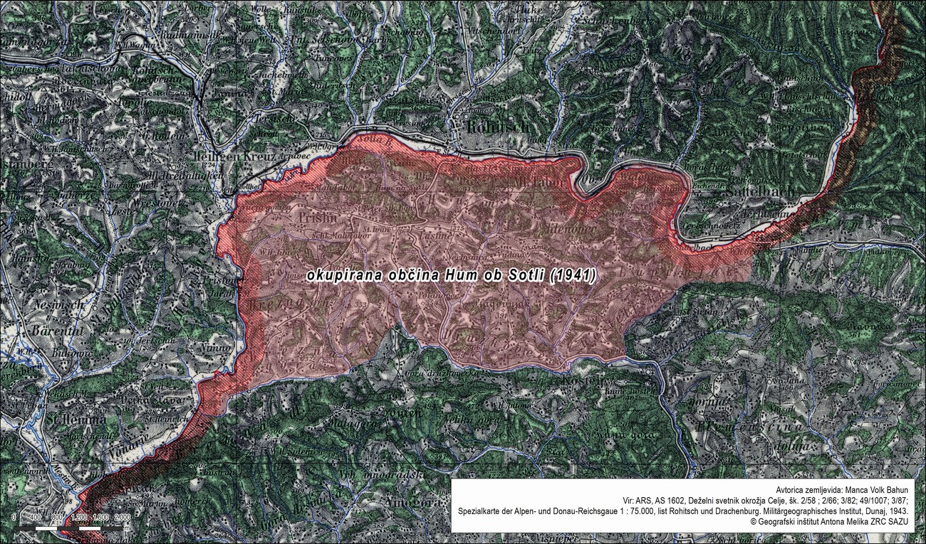
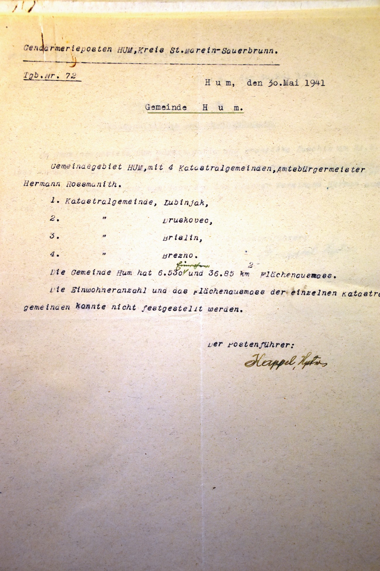
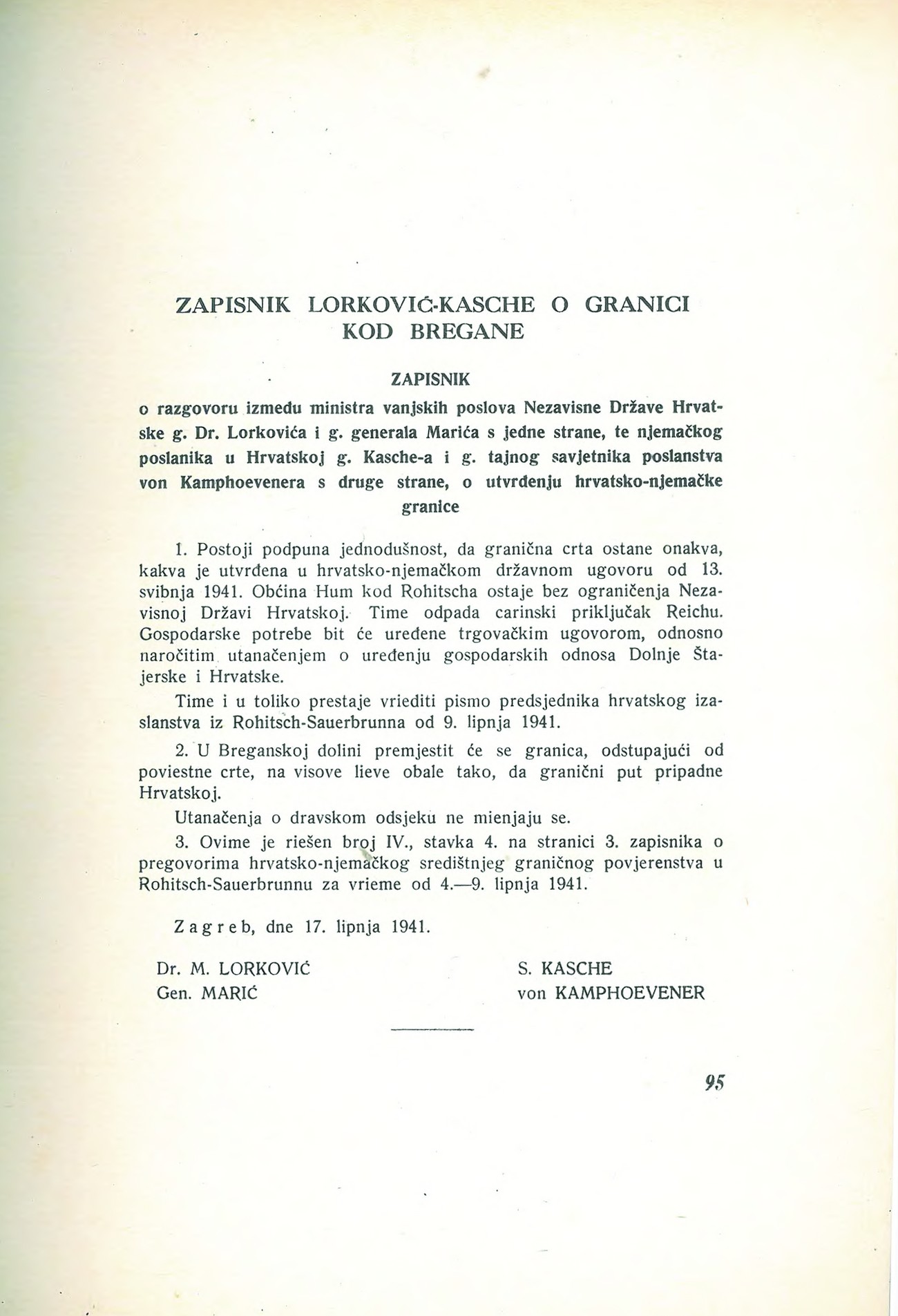
Germans occupy the Croatian Municipality of Hum na Sutli.

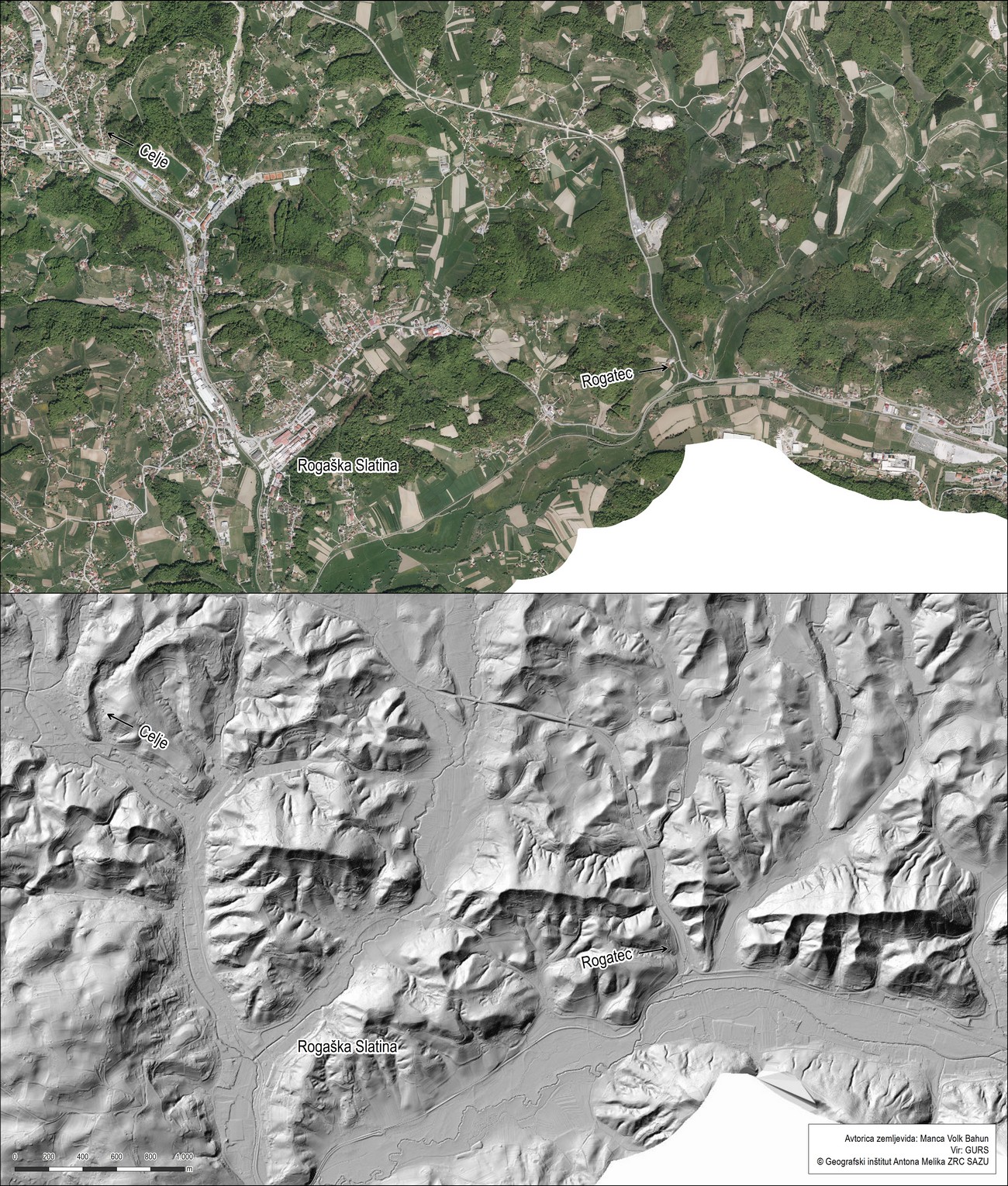
Few inhabitants of Rogaška Slatina and its surrounding area are familiar with the fact that when Yugoslavia was occupied in 1941 and Slovenia was carved up among Italy, Hungary, the NDH and Germany, the present-day Croatian Municipality of Hum na Sutli and its corresponding towns or hamlets of Hum, Lupinjak, Druškovec, Prišlin and Brezno were given to Germany. 6,530 (Croatian) inhabitants in an area of 36.85 square kilometres fell under Germany's rule, while the annexed territory belonged to the Šmarje District based in Rogaška Slatina. The main reason behind the annexation was industry – the Straža glassworks in Hum was highly advanced at that time and connected with the Štajerska region. Its owner was German. Thus, the border did not run along the Sotla River but along the banks of the Hrvatsko Zagorje region. In the end of June, after allegedly being persuaded by the NDH, this area was re-annexed to Croatia and the border was moved to the Sotla River.

The primary school in Rogaška Slatina (the present-day 3rd Primary School of Rogaška Slatina) was built in 1888; due to the financing of its construction and the influence over its educational programme it was called the German school. It held lessons during the war. Published courtesy of Robert Reich (Rogaška Slatina once upon a time), who owns the original.


Okupirana občina Hum ob Sotli (1941)


A report from the Hum Gendarmerie Station (the Šmarje District based in Rogaška Slatina) dated 30 May 1941 on the Occupation Municipality of Hum, which, besides Hum, also included four corresponding cadastral units – Lupinjek, Druškovec, Prišlin and Brezno. Archives of the RS.


The minutes of an agreement between the German Ambassador Siegfried Kasche and the Croatian Foreign Minister Mladen Lorković on 17 June 1941, which state that the border at Rogaška Slatina will run along the Sotla River, as it had prior to April 1941. Source: Nezavisna država Hrvatska, Ministarstvo vanjskih poslova. Međunarodni ugovori 1941. P. 95.


The material remains of the war also include the remains of fortified defensive lines, positions or borders from the time of World War II on Slovene territory. We can still recognise many trenches or foundations of various buildings in the landscape today. Tracking these remains in the field is time-consuming and often made difficult because the cultural landscape has changed greatly over the last seven decades. Characteristic of Slovenia in the post-war period was the process of land abandonment and the consequent overgrowing of the cultural landscape. In recent years, historians have been making use of laser surface scanning to detect such remains. LiDAR (Light Detection and Ranging or Laser Imaging Detection and Ranging) is more efficient compared to aerial photography as it can “see” through vegetation. This enables the making of a highly precise Digital Relief Map (DRM) in a resolution of 1m or higher, which enables us to identify elements of such size in the landscape.