Menu

Due to the border, the Germans had to build a new infrastructure

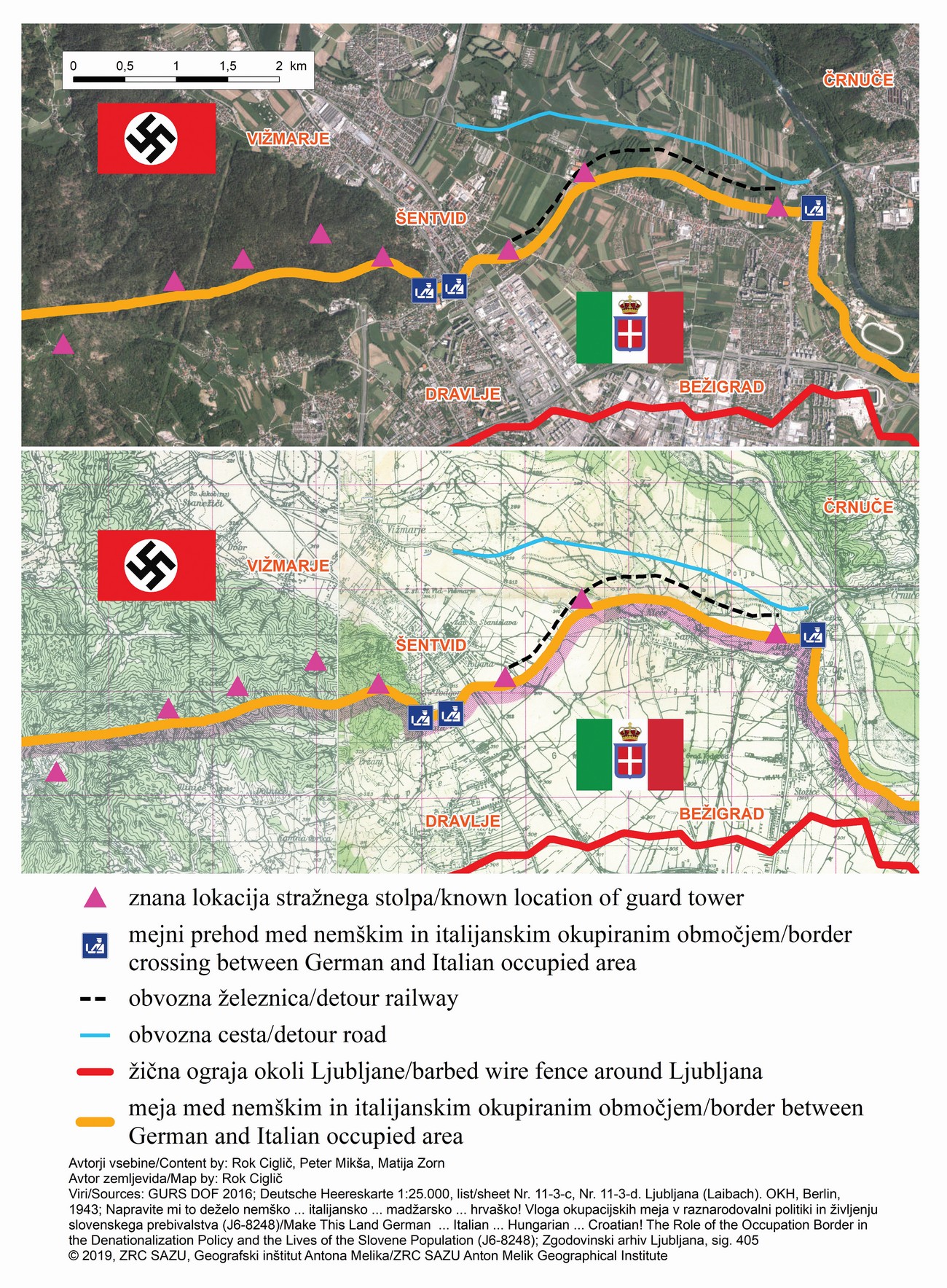
The border between Italy and Germany has cut off road links and the railway line between the German occupied territories northwest and northeast of Ljubljana. The Germans were therefore forced to build a new road and a new railway section between the then settlements of Vižmarje and Črnuče. While this railway section is no longer today, the road has been preserved. Today it has the name Obvozna cesta (“Detour” Road), but among the residents of Ljubljana it is better known as the “German” road. The road still has the character of a connection road, since it represents the shortest connection in the northern part of the city between Šentvid or Vižmarje and Ježica or Črnuče.


On (A) an aerial photograph from 1959 the course of the former WWII German railway is visible. On (B) a 3D 1959 landscape model made from stereoimaging, it can be seen that the railway ran along a cut and an embankment. After the war the railway was dismantled and the embankment was removed, so that on present-day LiDAR DTM (D) these anthropogenic relief forms are almost non recognizable, while the course of the former railway can be recognized on a 2011 aerial photograph (C) based on the land use.