The border between Germany and the NDH was about 100km long; most of the borderline ran along the Sotla River. For the most part, the new border matched the ethnic and old administrative border of previous state-political formations in that area, since the Sotla River had functioned as the national border between Slovenes and Croatians for centuries. In addition to the German border with Italy, this border on the Sotla River in the lower Štajerska region became the southernmost and protective border of the envisaged Thousand-Year Reich.
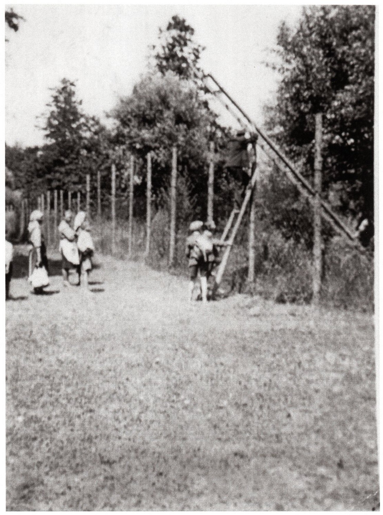
As was the case in all other occupiers’ borders in Slovene lands, the German administration also fenced in and secured its southern state border. Initial fortification works were finished by the late autumn of 1941. The Germans protected the border with barbed wire, minefields and border guardhouses placed in between; in March 1943, decrees on the urgent construction of watchtowers were issued. The wire, up to 2 metres tall, was placed on wooden posts that were evenly spaced along the riverbed every few metres. The minefield along the wire was about two to four metres wide.
It became very difficult and unpleasant to cross the border; moreover, it was possible only with a border pass. Due to a shortage of goods, the inhabitants, especially those living near the border, started smuggling goods across the border, thus illegally crossing it. From the Croatian side they carried tobacco and meat across the river, and in exchange their Slovene neighbours gave them salt, flour, sugar or coffee and even vitriol. They would also exchange bread, butter, milk, eggs, and important letters across the border.
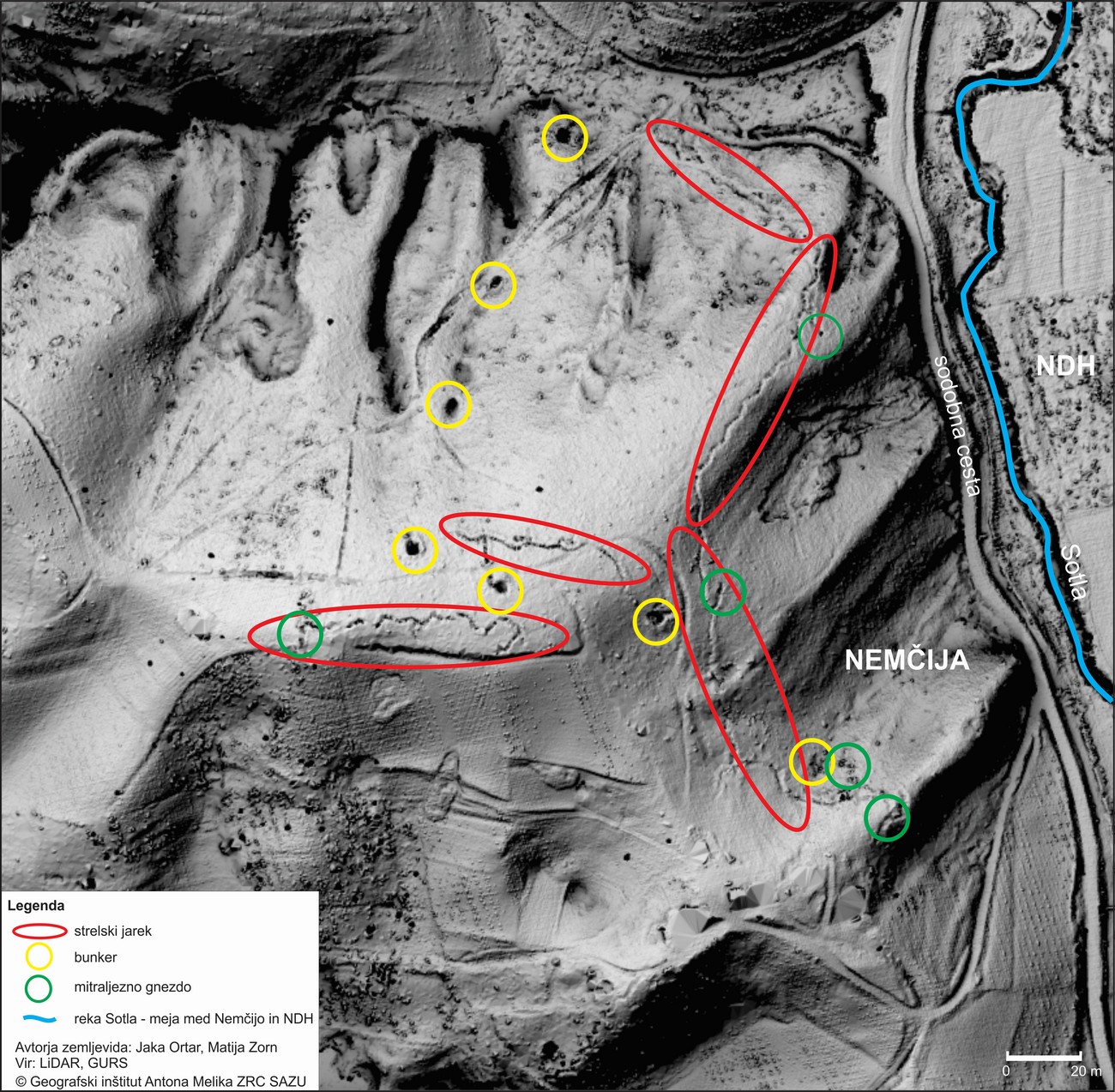
In October 1944, Germans began large-scale fortification works along the entire border. They built firing trenches, machine-gun nests and bunkers, whose remnants are still clearly visible in the area today. They mobilised the local population, even those more than 20 kilometres away from the border, to perform heavy manual labour. After 1945, the atrocities of war were not yet over for the locals. The land mines that had been left behind along the Sotla River were the main cause of numerous casualties among the population, even many years after the war had ended.
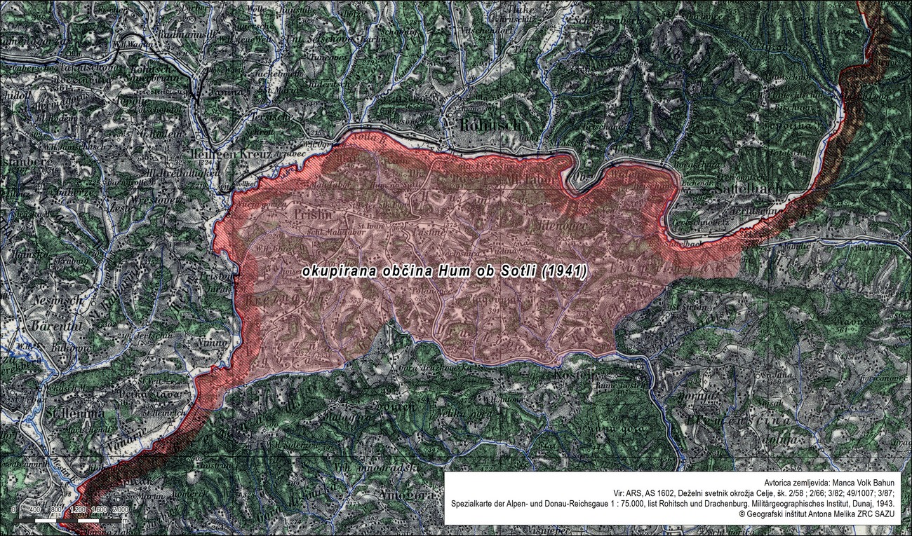
When Yugoslavia was occupied in 1941 and Slovenia was divided among Germany, Italy, Hungary and the NDH, the present-day Croatian Municipality of Hum na Sutli and its towns or hamlets of Hum, Lupinjak, Druškovec, Prišlin and Brezno was given to Germany. 6,530 (Croatian) inhabitants in an area of 36.85 square kilometres came under Germany's rule, while the annexed territory belonged to the Šmarje District based in Rogaška Slatina. The main reason behind the annexation was industry – the glassworks Straža in Hum was highly advanced at that time and connected with the Štajerska region. Its owner was German. Thus, the border did not run along the Sotla River but along the banks of the Hrvatsko Zagorje region. In the end of June, after being persuaded by the NDH, this area was re-annexed to Croatia and the border was moved to the Sotla River.
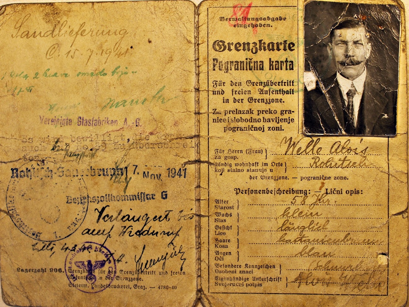
Example of a bilingual border pass (Grenzkarte). In addition to the official stamp of the district customs office, and the date of issue and validity, each permit also contained a description of its owner with information on age, occupation and place of employment. Archive of the RS.
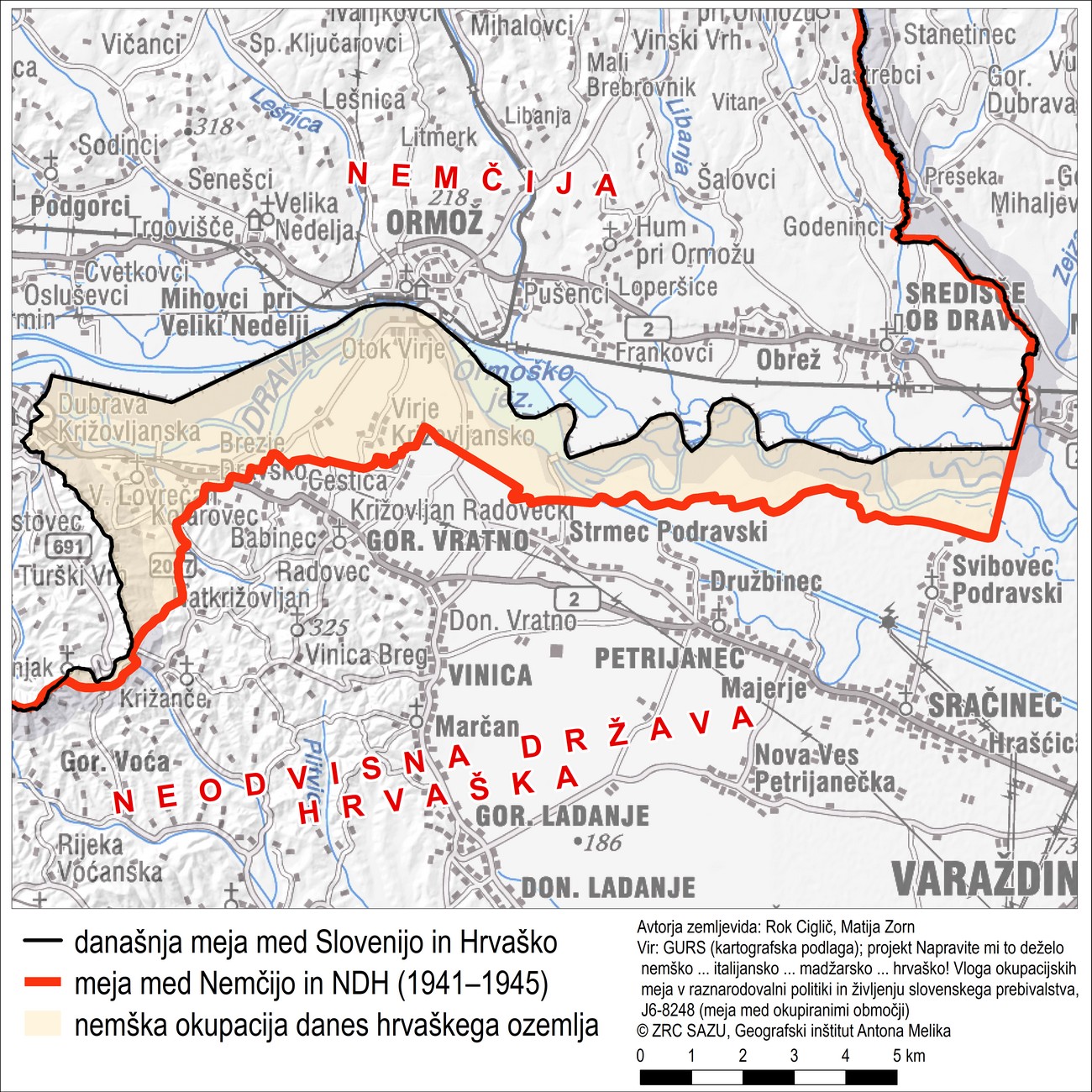
Today the territory south of Drava close to Ormož is part of Croatia, however in 1941 it was part of Germany; more precisely, it was part of the German state province of Styria (Reichsgau Steiermark).
The Sotla river is still a border river between the Republic of Slovenia and the Republic of Croatia. However, between 1941 and 1945 this was the border river between the German Reich and the NDH. At the end of 1941, the Germans heavily guarded its banks and enclosed it with barbed wire and minefields. Nevertheless, smuggling soon emerged across the river. Most sought after commodities were sugar, tobacco, copperas, salt, meat, lard, flour, eggs, even livestock. The photograph shows the exchange of goods at Sotla river in the immediate vicinity of Rogaška Slatina, most likely in the summer of 1944. Source: personal archive of Božo Kolar.
The map shows a microstudy of second world war remnants in the field as shown on a Lidar image – the location is Vonarje. In 1944, in anticipation of a potential landing of allies in Istria, the Germans greatly fortified their southern border with firing trenches, machine gun nests and fortified bunkers.
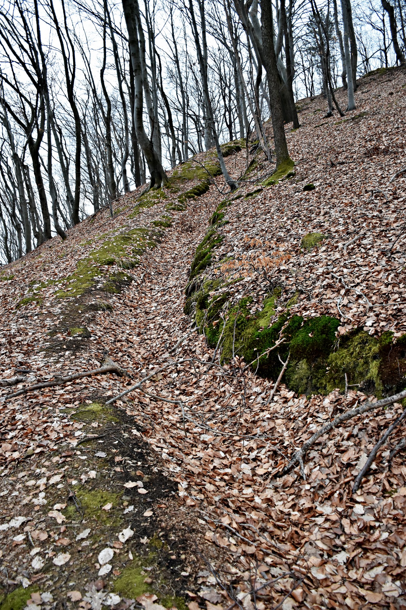
Remains of a firing trench above the Sotla River at Vonarje. Author: Daniel Siter.