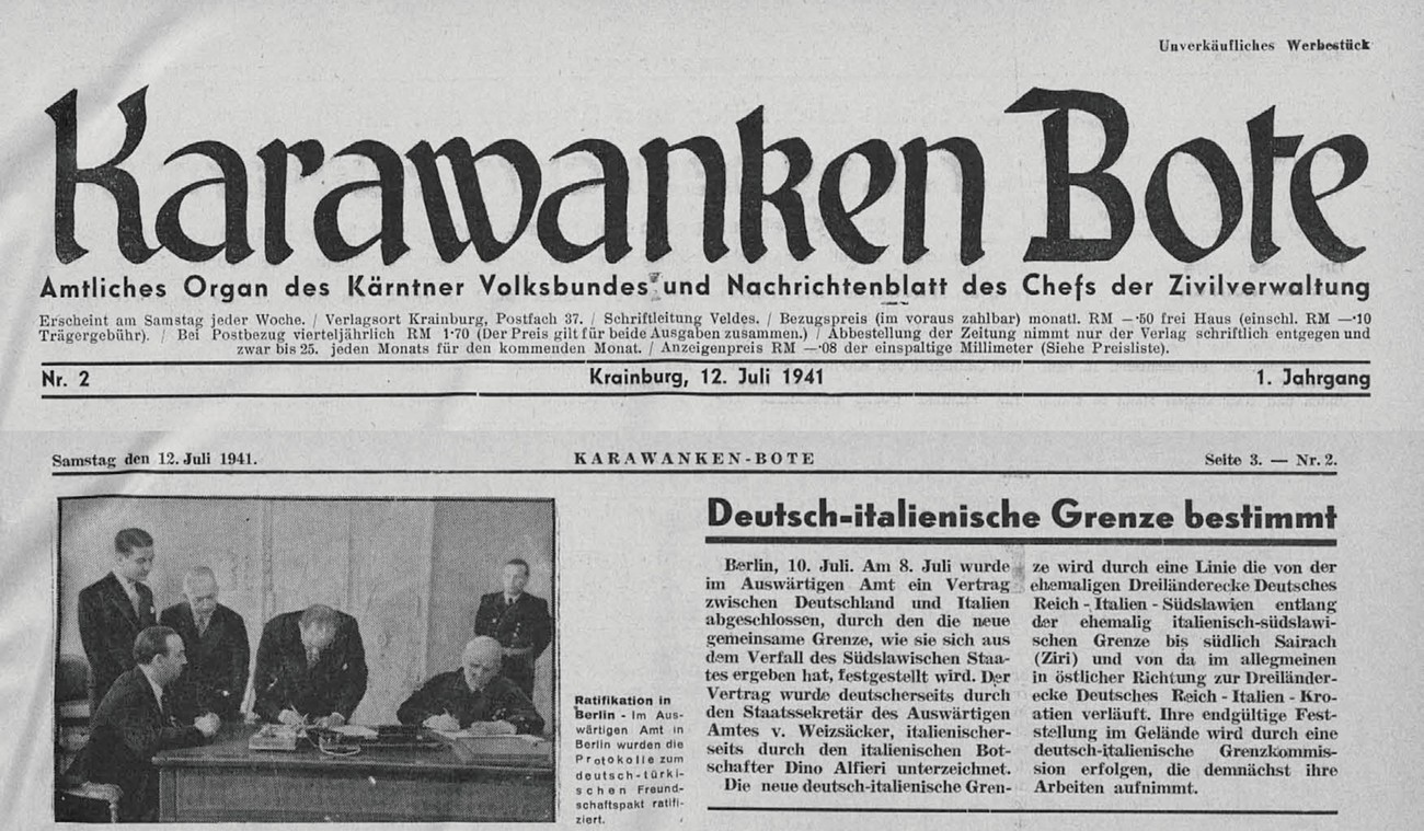
No special negotiations or conferences were held regarding the division of Slovene territory among the occupiers. The boundaries were roughly fixed by Hitler on 27 March 1941, and ultimately by his “Guidelines for the Division of Yugoslavia” on 3 and 12 April 1941 at one of his main headquarters in Mönichkirchen near Vienna. On 22 April German and Italian delegations led by foreign ministers Ribbentrop and Ciano, held the conference on the division of occupied Yugoslavia in Vienna. Italians were only allowed to comment on Hitler’s decisions despite Cianos personal talks with Hitler. Afterwards, the German-Italian Boundary Commission, established with a state treaty on 8 July 1941, was allowed to make only a few smaller corrections. It was similar in the case of Hungary, where Germany initially wanted to keep Prekmurje but later settled for four German villages in the Goričko region for the sake of Hungarian alliance.
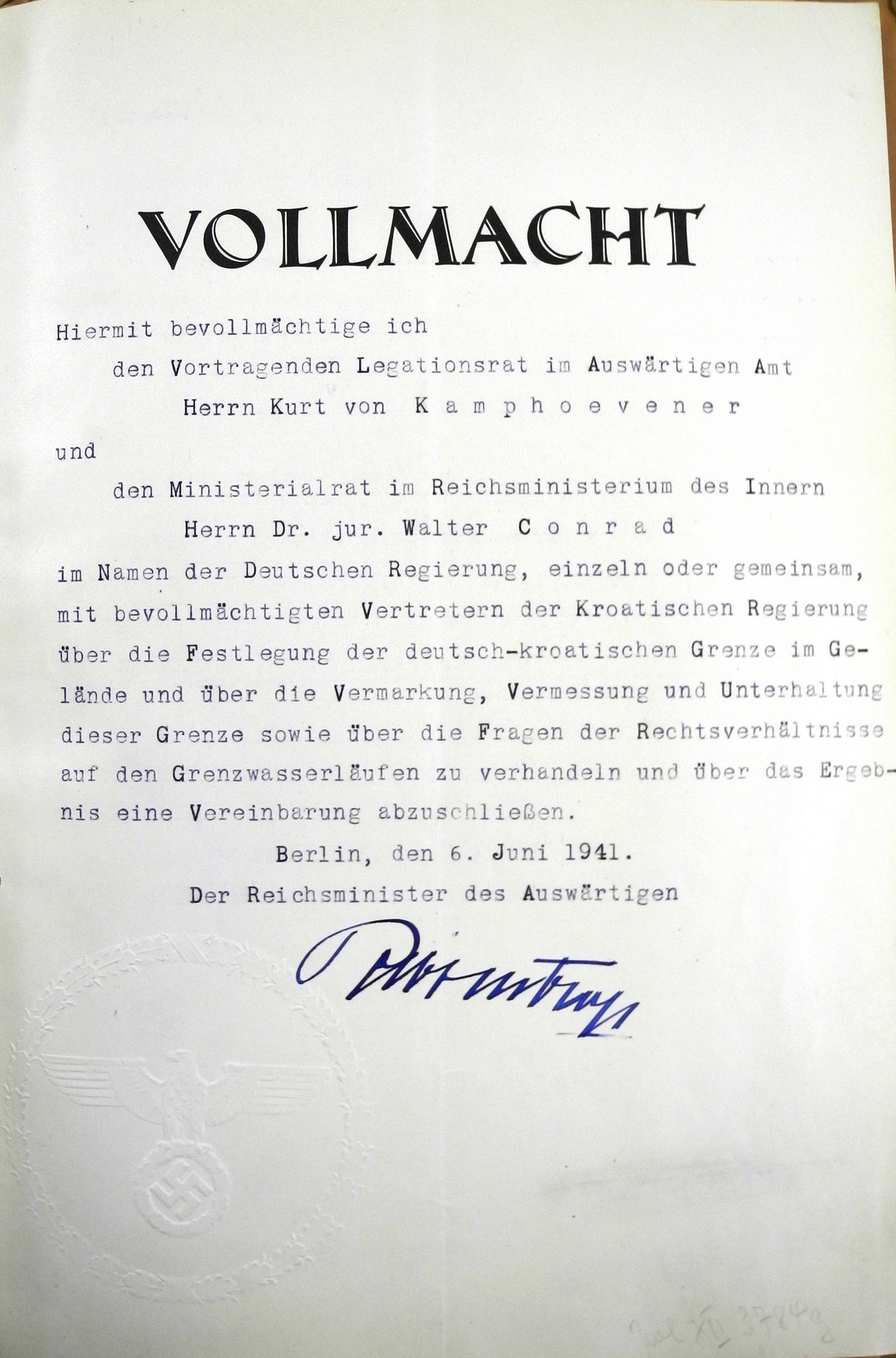
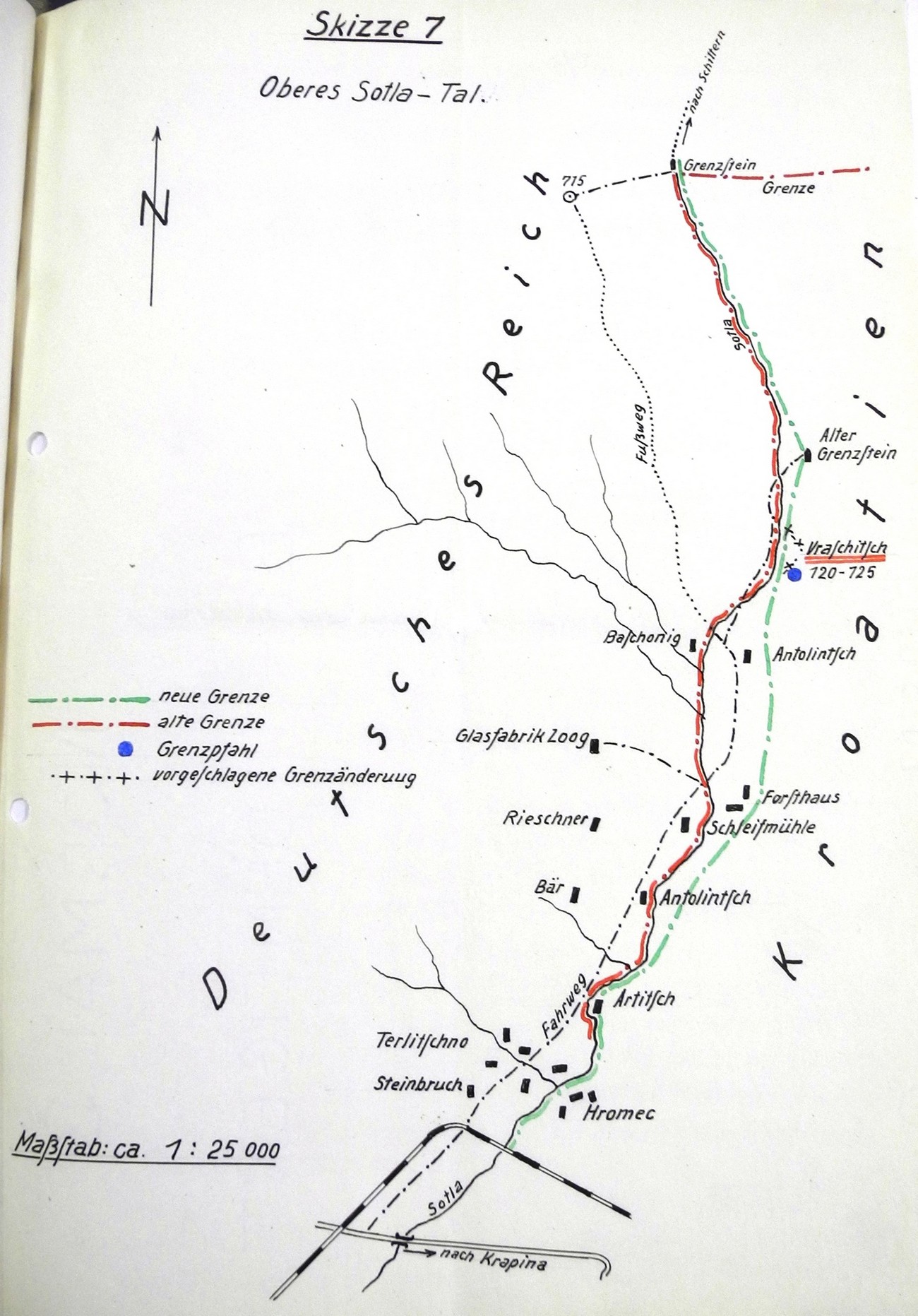
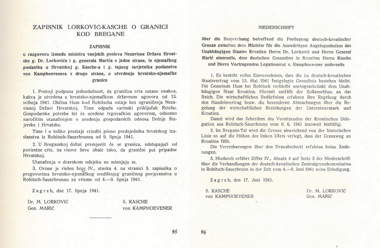
A treaty on the border between Germany and Hungary was signed on... A treaty on the border between Germany and Italy was signed on 8 July 1941 in Berlin, and a treaty between Italy and the NDH on 18 May 1941 in Rome. In its relationship with Italy the NDH was likewise unable to assert its demands. There was no official treaty between Hungary and the NDH, because the NDH did not agree with the Hungarian annexation of Međimurje. Germany and the NDH signed a state treaty on borders on 13 May 1941. However, a German-NDH Boundary Commission later on resolved certain smaller unsettled issues, with Germany having the final say. Among other things, Croats wanted Razkrižje (which they did not get) and Hum na Sutli (sentimentally explaining that the municipality contained the manor of Antun Mihanović who had written the Croatian national anthem in 1846). In exchange, the NDH was willing to give Germans the riverbank zone on the southern side of the Drava River near Vinica. The NDH Head of State (“Poglavnik”) Ante Pavelič did order a comprehensive collection of data which would later be used to correct the border with the Reich on Slovene territory, but it never took place.
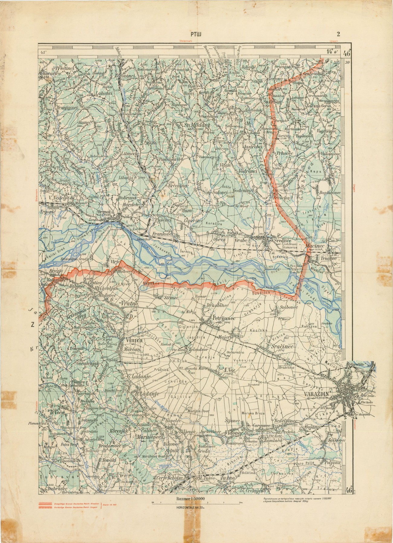
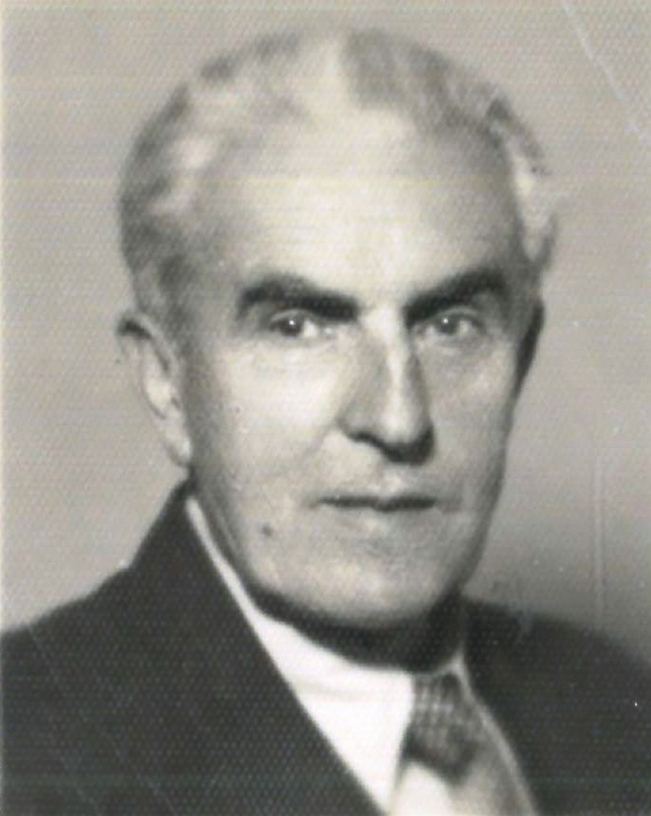
The leading German negotiator in the field was the diplomat Kurt von Kamphoevener (17 July 1887 Istanbul – 11 February 1983 Garmisch-Partenkirchen). In the years 1941-1943, acting as the head of German delegations for resolving border issues and as Ribbentrop’s plenipotentiary, he regulated border issues with Italy, Hungary, Slovakia and the NDH, and was also active elsewhere throughout the Balkans. During negotiations over Slovene territory he had offices in Bled, Ljubljana and Rogaška Slatina. He was the son of the German Officer and Turkish Marshal Louis von Kamphövener. He studied law in Heidelberg, Oxford and Göttingen. From 1911 onwards he was employed by the Ministry of Foreign Affairs. He served in Madrid (1911-1913), Sydney (1913–14), Sofia (1916–18), London (1920–23), Liverpool (1923–26) and Madrid (1926–31). In 1930, he joined the Social Democratic Party and then NSDAP in 1940. Besides other languages, he had also learnt Russian and in 1939 led the commission for relocating the Volksdeutsche from the Polish territories given to the Soviet Union. After the occupation and breakup of Slovenia, he was Germany’s representative before the High Commissioner for the Province of Ljubljana in Ljubljana from mid-October to mid-November 1941, where he organised the relocation of Gottscheers in a similar way. During the war he was also a communications officer for the Military Intelligence Service (Abwehr) in Russia, Athens, Vrnjačka Banja and Zagreb. In August 1945, an American interrogator called him “highly cultivated and critical of the Nazis.” In 1945 and 1946, he was an American prisoner of war, but in 1946 he already began teaching foreign languages in Hamburg. In 1950, he rejoined diplomatic service and acted as the German consul general in Istanbul until his retirement in 1952.