Menu

Tripoints

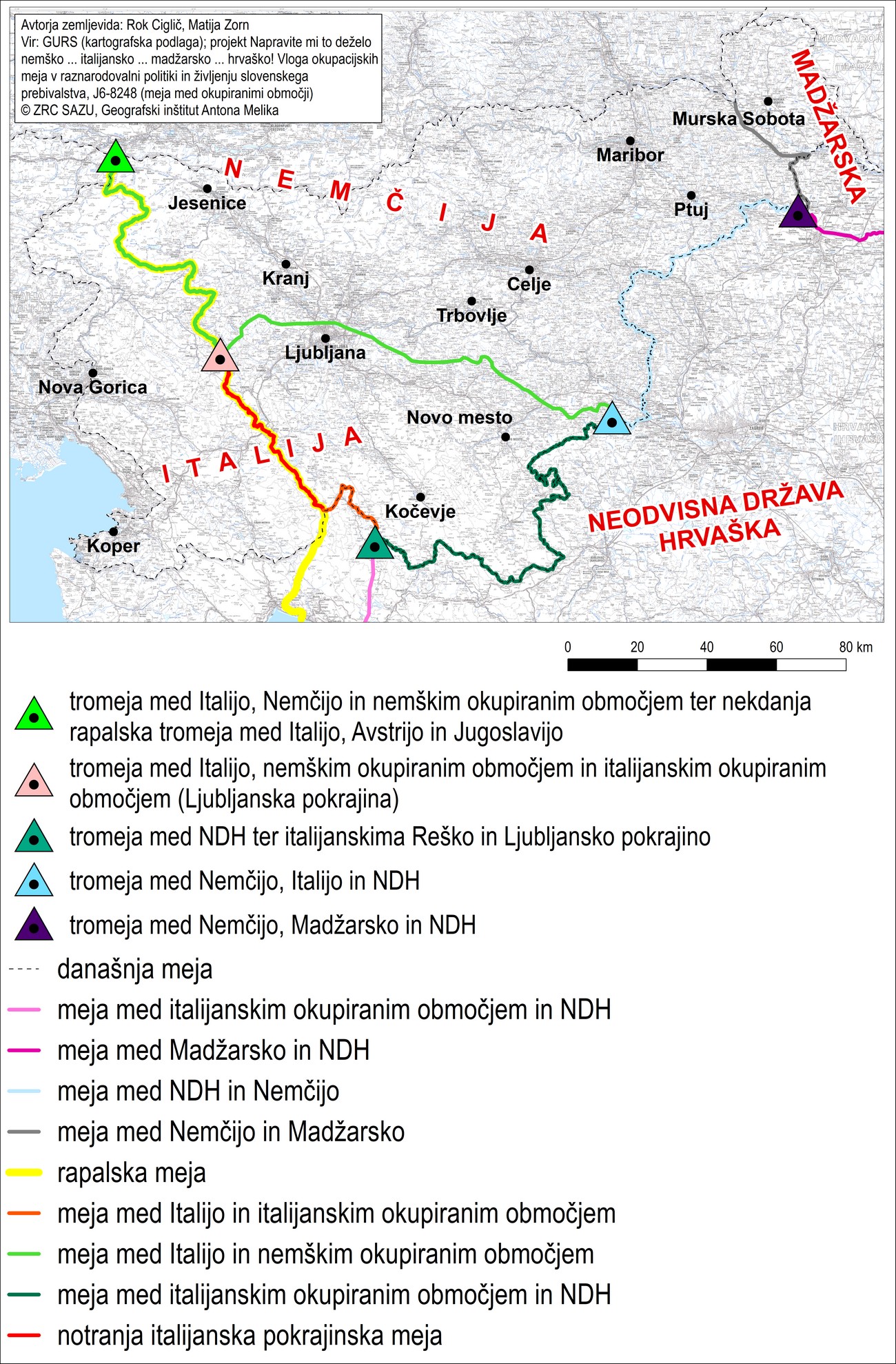
World War II established four tripoints on Slovene territory, which were marked on maps and in the field. The tripoints in Spodnji Vrsnik near Žiri and in the present-day Croatian Municipality of Svibovec Podravski near Središče ob Dravi were new, while the tripoint at Peč near Rateče in the Gorenjska region and the one at Gadova Peč in the present- day Municipality of Brežice were old administrative and international boundary points.

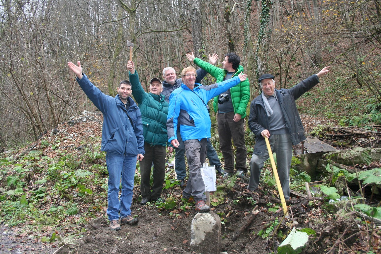
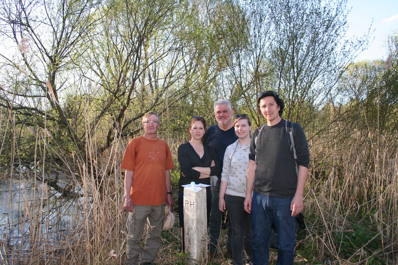
The tripoint at the village of Brvi beneath Gadova Peč was the old administrative border of the Habsburg Monarchy, separating the Austrian from the Hungarian half of the empire. Between 1941 and 1943, it served as the border between the Third Reich, the Italian Occupation Zone and the NDH. This tripoint reached deeply into the territory of the former Carniola, yet the boundary marker that marked the tripoint was an old Austrian one. The research team found it with the help of precise calculations, dug it up, and properly marked it.

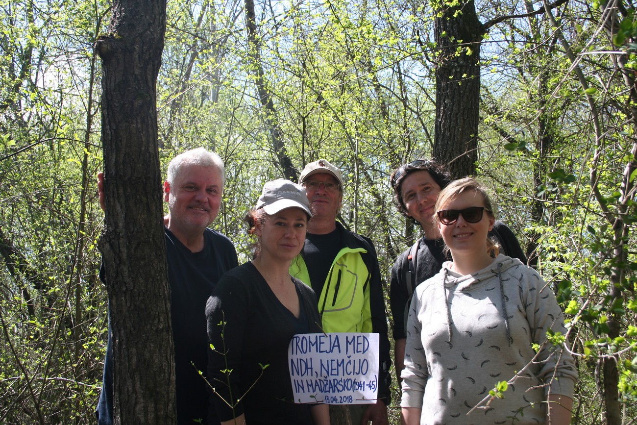
The second tripoint of the Eastern side of Slovenia, south of Središče ob Dravi marked the junction between the occupation zones of the Third Reich, Hungary, and the NDH. The tripoint’s location was forgotten through time, but the research team rediscovered it using the calculations obtained by comparing the maps from the World War II with new ones, which deviate by no more than 25 metres. Today, the tripoint is located in the Republic of Croatia, in the Municipality of Svibovac Podravski. Interestingly, in this area the Hungarian Occupation Zone reached across the Drava River.

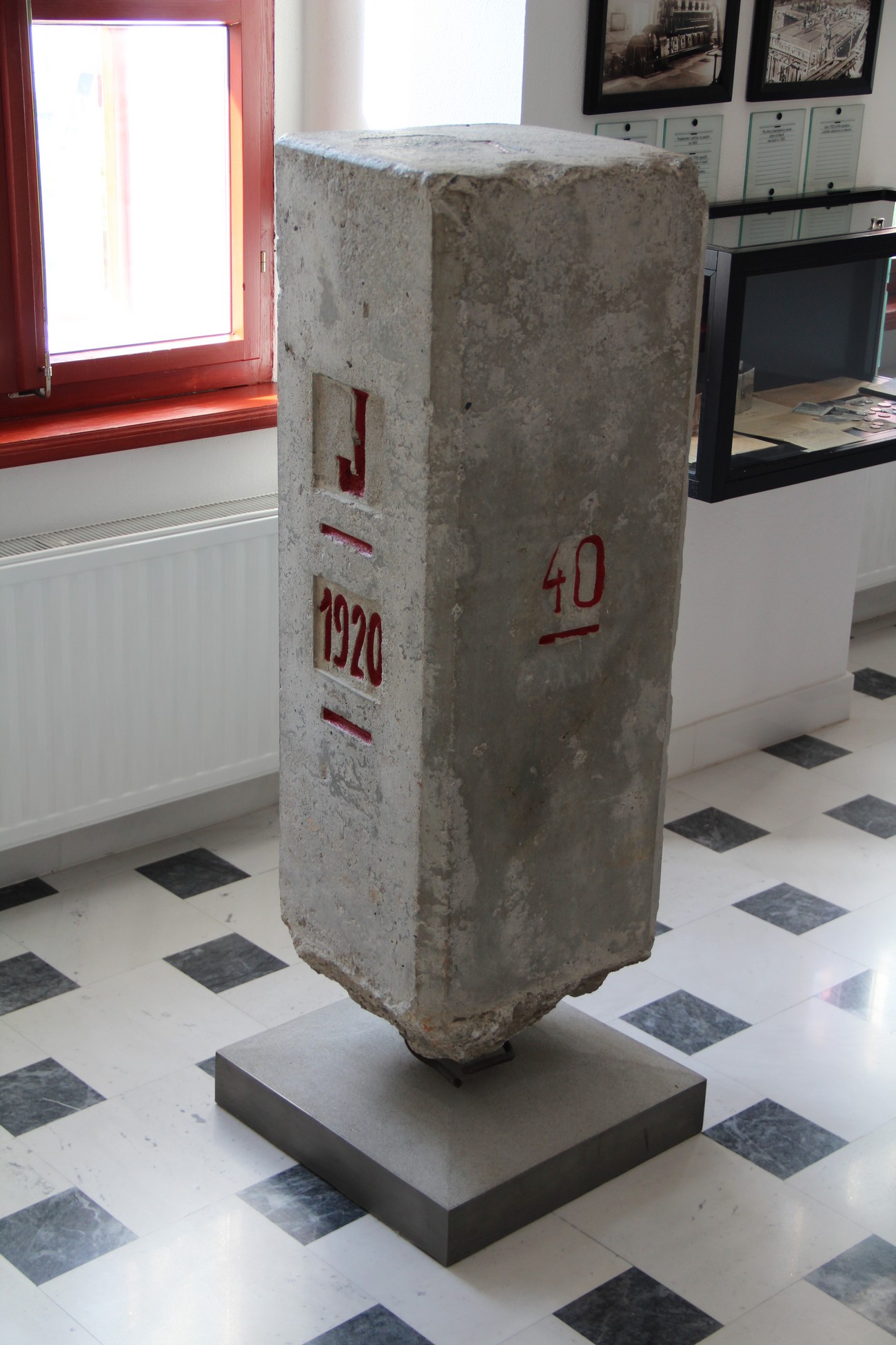
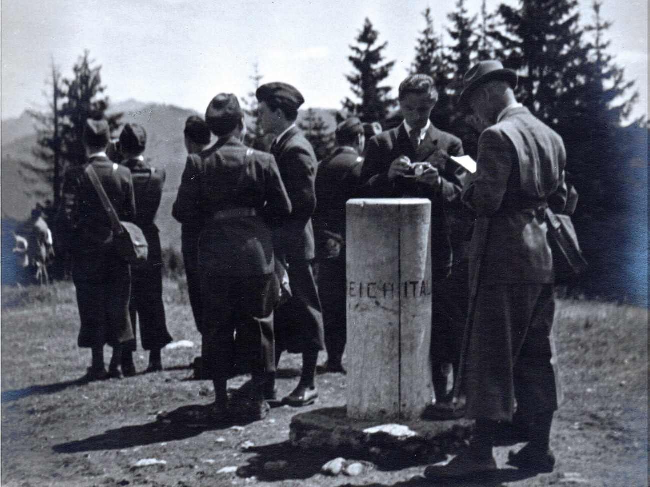
Ever since World War I, the Rapallo border had cut Slovene ethnic territory in two. Consequently, all of the border points were originally bilateral. When the war broke out, Italy occupied another part of Slovene territory, the so-called Province of Ljubljana. Its administration differed from that of the annexed territories beyond the Rapallo border. The difference between these two territories resulted in the fact that the Rapallo boundary marker No. 40 became a tripoint marker between the German Reich, the Kingdom of Italy and the Italian Occupation Zone – the Province of Ljubljana. The marker was located in the village of Spodnji Vrsnik near Žiri.

The fourth tripoint was located at Mount Peč near Rateče, where it still exists today. It had been a provincial tripoint until World War I, and later became a junction point between three countries. The only exception was the period during World War II when this point demarcated the Kingdom of Italy, the German Reich and the German Occupation Zone of Lower Carinthia. This was therefore the starting point of the part of the Rapallo border that was transformed into the state border between Italy and Germany during World War II, and which ended with the above-mentioned tripoint in Spodnji Vrsnik.

On 16 November 2017, a part of the research team (Matija Zorn, Božidar Flajšman, Božo Repe, Peter Mikša), accompanied by Lojze Štih and Ivan Petrišič, the president and vice-president of ZZB NOB Krško, discovered a buried boundary marker in a remote area of the Municipality of Brežice near Gadova Peč, at the tripoint between Germany, Italy and the Independent State of Croatia. Author: Božidar Flajšman.


The photograph shows the research team (from left to right: Božidar Flajšman, Darja Kerec, Božo Repe, Peter Mikša in Kornelija Ajlec) marking the tripoint with an improvised inscription. On 13 April 2018, the research team marked a tripoint between Germany, Hungary and the Independent State of Croatia on the over grown right bank of the Drava River, south of Središče ob Dravi on today’s Croatian side. No physical remains of the former state border can be found in this flooded, muddy region, rich in vegetation. Author: Božidar Flajšman.


During World War II, boundary marker No. 40 of the Rapallo border in Spodnji Vrsnik became a tripoint marker between Germany, the Kingdom of Italy and the Province of Ljubljana, Italy's new occupation zone. Today this marker is kept by the museum Mestni muzej Idrija. Source: Idrija Municipal Museum, Author: Darko Viler.


A map of tripoints in Slovenia during World War II.


During World War II, the present-day tripoint between Austria, Italy and Slovenia was the tripoint between the Kingdom of Italy, the German Reich and the German Occupation Zone of Lower Carinthia. Unfortunately, the monument from those times has not been recorded, but we can see the tripoint marker from 1939 when it was visited by the underage King of Yugoslavia Peter II Karađorđević. Source: Nani Poljanec, Ljudski muzej Rogaška Slatina/Rogaška Slatina Folk Museum.


Božo Repe, Darja Kerec, Božidar Flajšman, Kornelija Ajlec and Peter Mikša at the present-day tripoint marker between Hungary, Slovenia and Croatia. Author: Božidar Flajšman.